Livingston Parish History

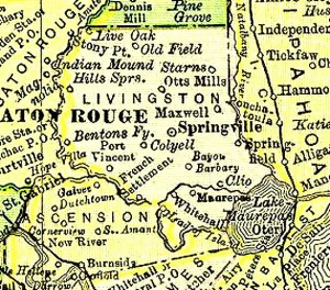
Livingston Parish was originally part of the Florida Parishes. The parish was created February 10, 1832, when the state Legislature split St. Helena Parish in two. Historians differ as to which one, but the parish was named after either Robert or Edward Livingston. In 1869, the parish lost territory when Tangipahoa Parish was created. It later gained land when Maurepas Island was made part of the parish.
Livingston Parish consists of 642 square miles on 410,880 acres and is 32 miles long by 30 miles wide. The geographical landscape varies from rolling terrain covered by slash pine and hardwood forests in the north to rich cypress forests and marshes that border Lake Maurepas and the Amite River to the south.
Livingston Parish has eight municipalities, with Denham Springs being the largest. Other municipalities are Albany, French Settlement, Killian, Livingston (the parish seat), Port Vincent, Springfield, and Walker.
